|
| |
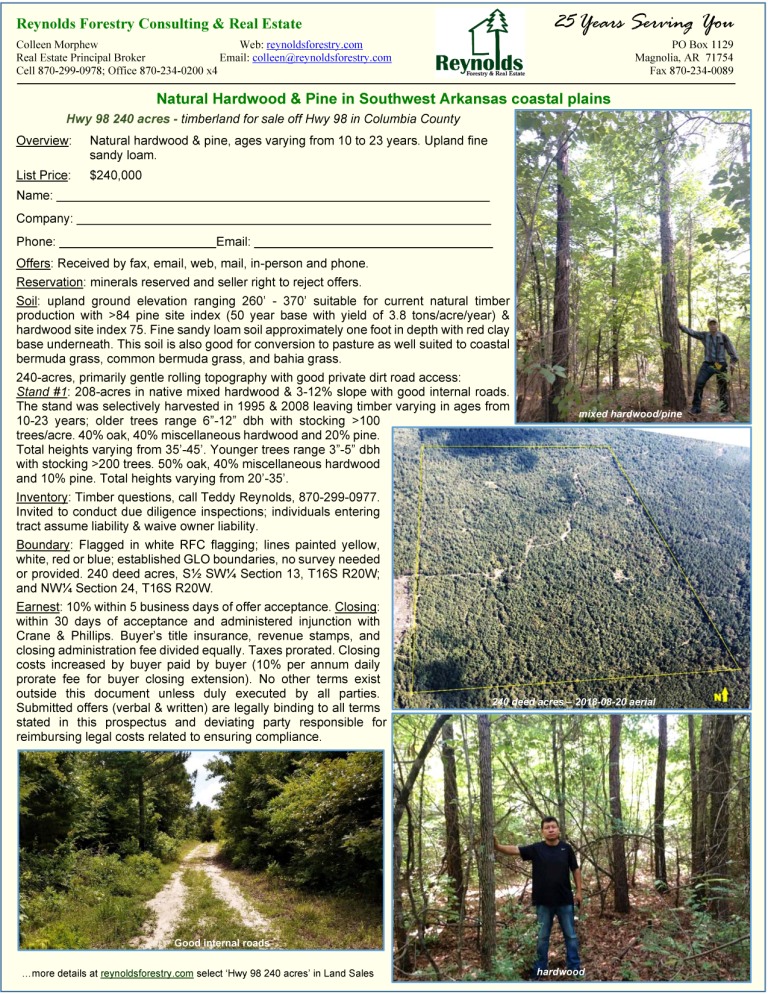
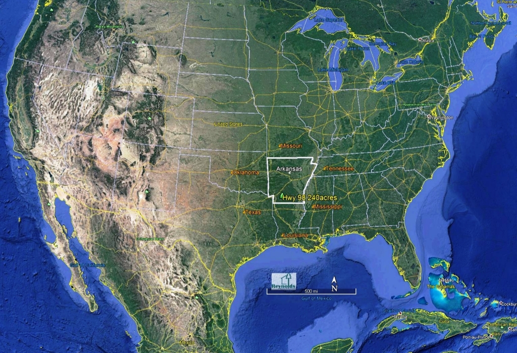
Natural
Hardwood &
Pine in Southwest Arkansas coastal plains
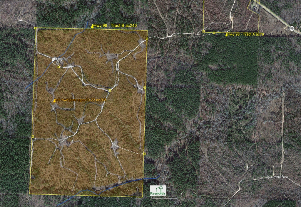
Hwy 98 240acres
List price:
$240,000
240 acres
natural hardwood & pine
(private access
off Hwy 98)
Overview:
Natural hardwood & pine, ages varying from 10 to 23 years. Upland fine sandy loam.
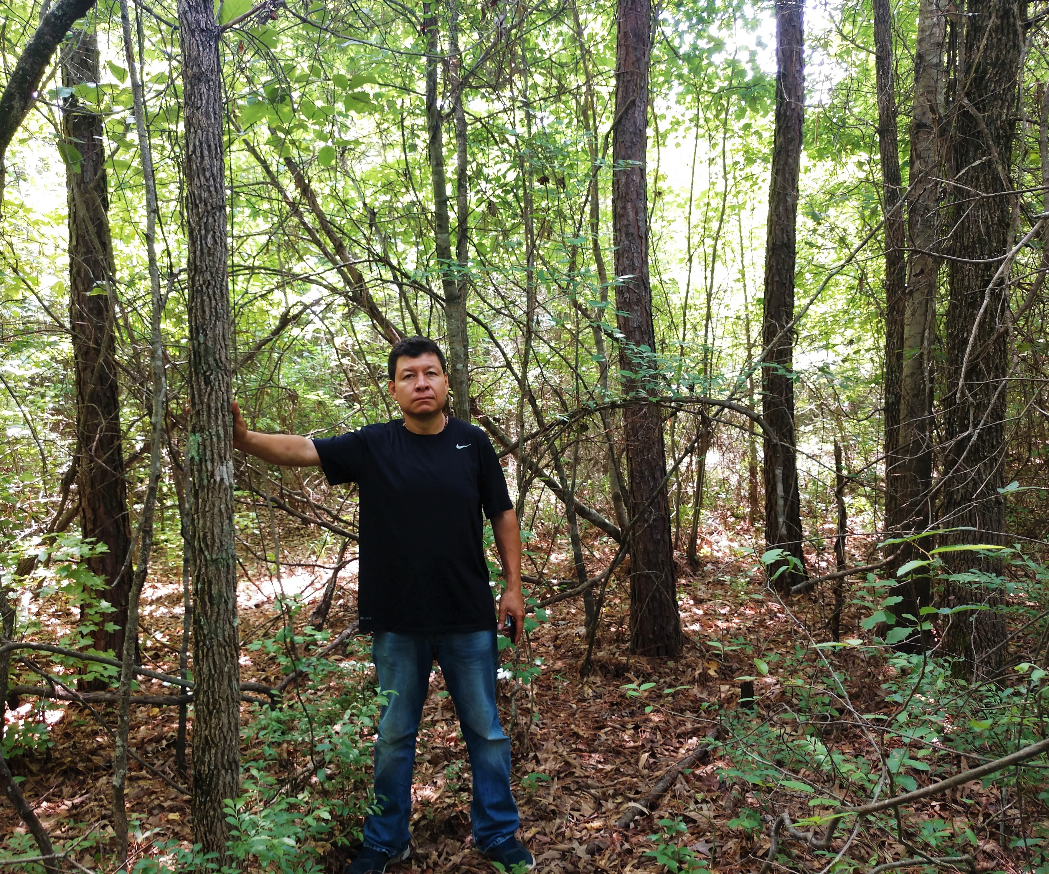
Inventory: Welcome to
conduct due diligent inspections/inventories. Individuals entering property
assume liability and waive landowner of liability.
|
|
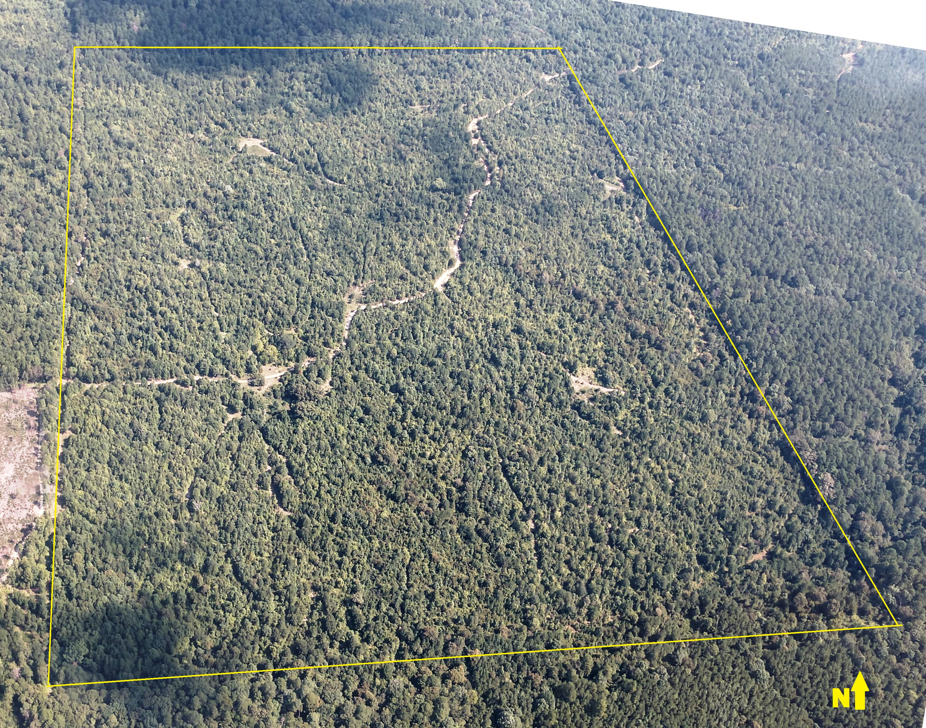
2018-08-20 Aerial flight
| |
|
|
|
|
|
|
|
|
|
|
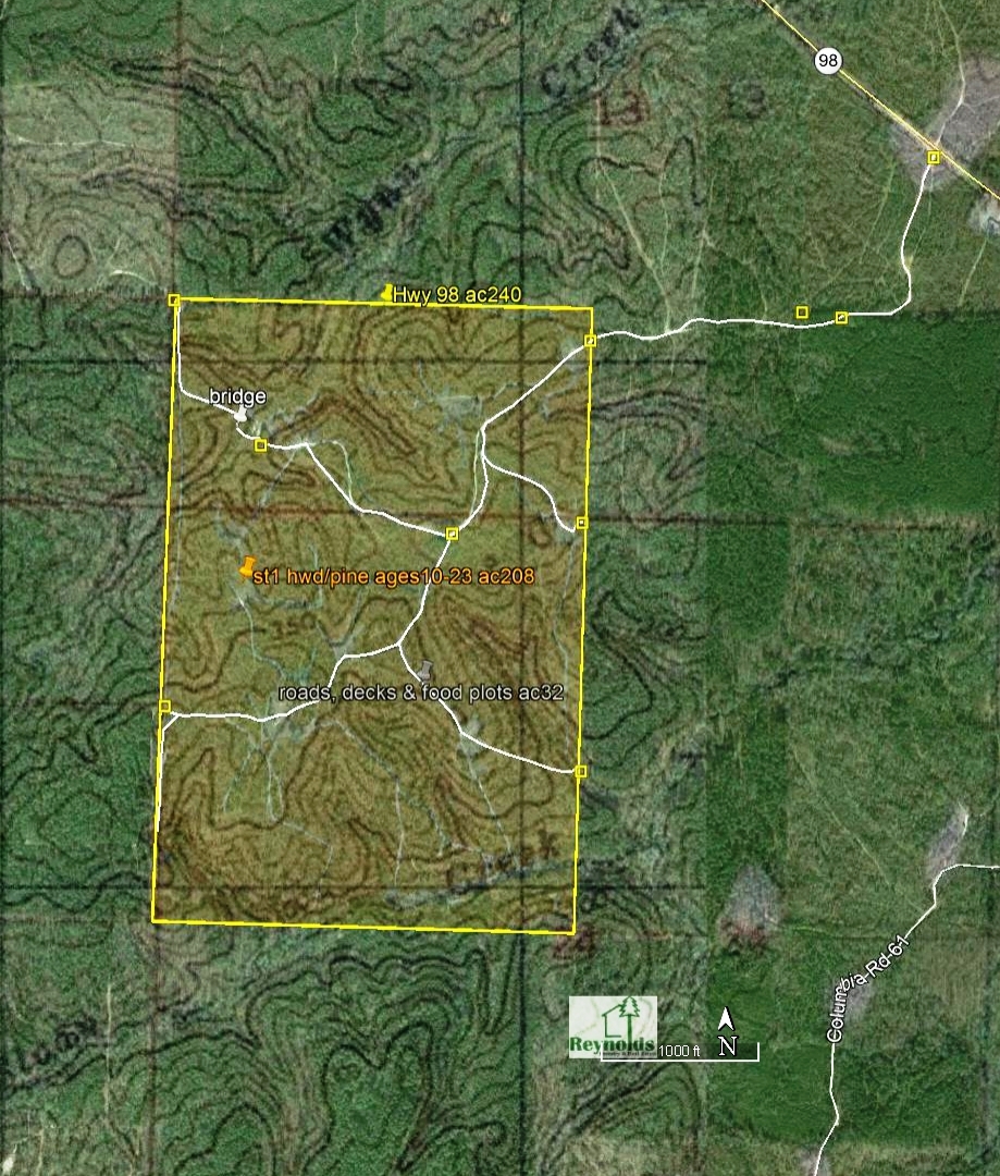
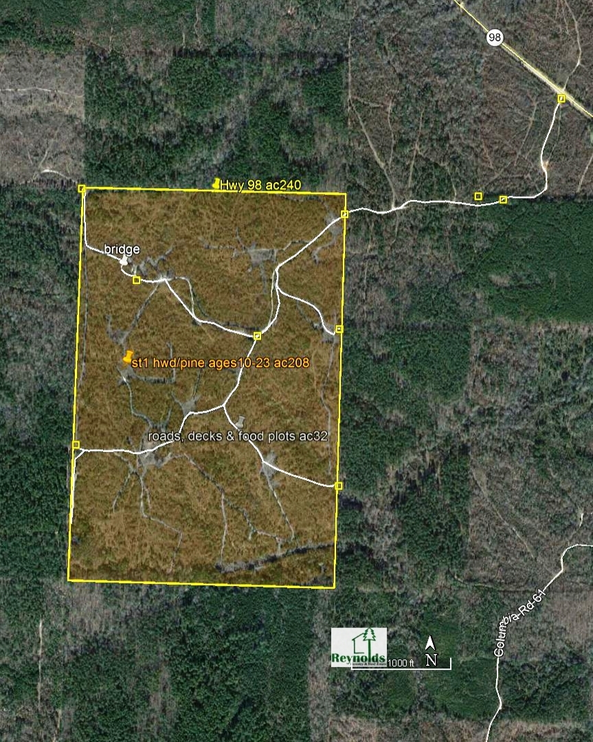
240 acres:
Primarily gentle rolling topography
and elevation of 260' -
370' with good private
dirt road access on upland ground
suitable for current natural timber
production with >84 pine site index (50
year base with yield of 3.8
tons/acre/year) and hardwood site index
estimated at 75. Fine sandy loam soil
approximately 1 foot in depth with red
clay base underneath. This soil is also
good for conversion to pasture as well
suited to coastal Bermuda grass, common
Bermuda grass, and Bahia grass. |
|
|
|
|
|
|
|
|
|
|
|
|
|
|
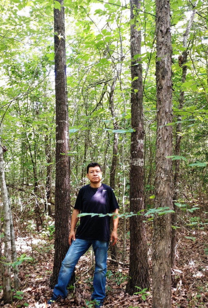
Stand
#1: 208-acres in native mixed
hardwood & pine on upland gentle rolling
3 - 12% slope with good internal roads.
The stand was selectively harvested in
1995 & 2008 leaving timber varying in
ages from 10-23 years; older trees range
in dbh from 6 to 12 inches with stocking
>100 trees/acre with 40% oak, 40%
miscellaneous hardwood and 20% pine with
total heights varying from 35 to 45
feet; younger trees range in dbh from 3
to 5 inches with 50% oak, 40%
miscellaneous hardwood and 10% pine with
stocking >200 trees with total heights
varying from 20 to 35 feet. |
|
|
stand |
acres |
type |
age |
|
range |
average |
|
1 |
208 |
hardwood & pine immature |
10 - 23 |
16 |
|
2 |
32 |
roads, decks & foodplots |
na |
|
|
240 |
|
|
|
|
Prospectus |
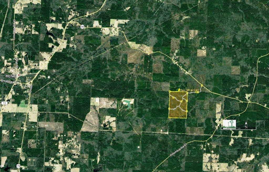
Vicinity Map
Bird's Eye Map |
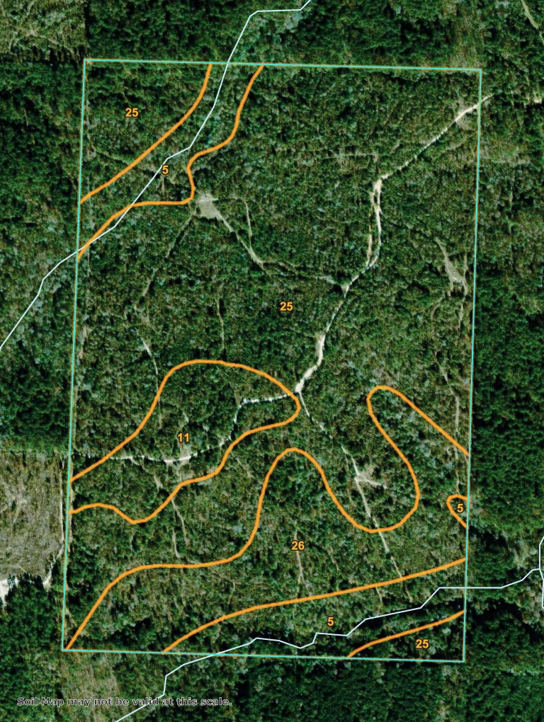
Soil Report |
|
Topo Map
|
Aerial Map |
USA Locator
Map |
stand 1 -
208-acres native hardwood |
stand
1 - hardwood mix, age range 10-16years |
Click to view in Google Maps |
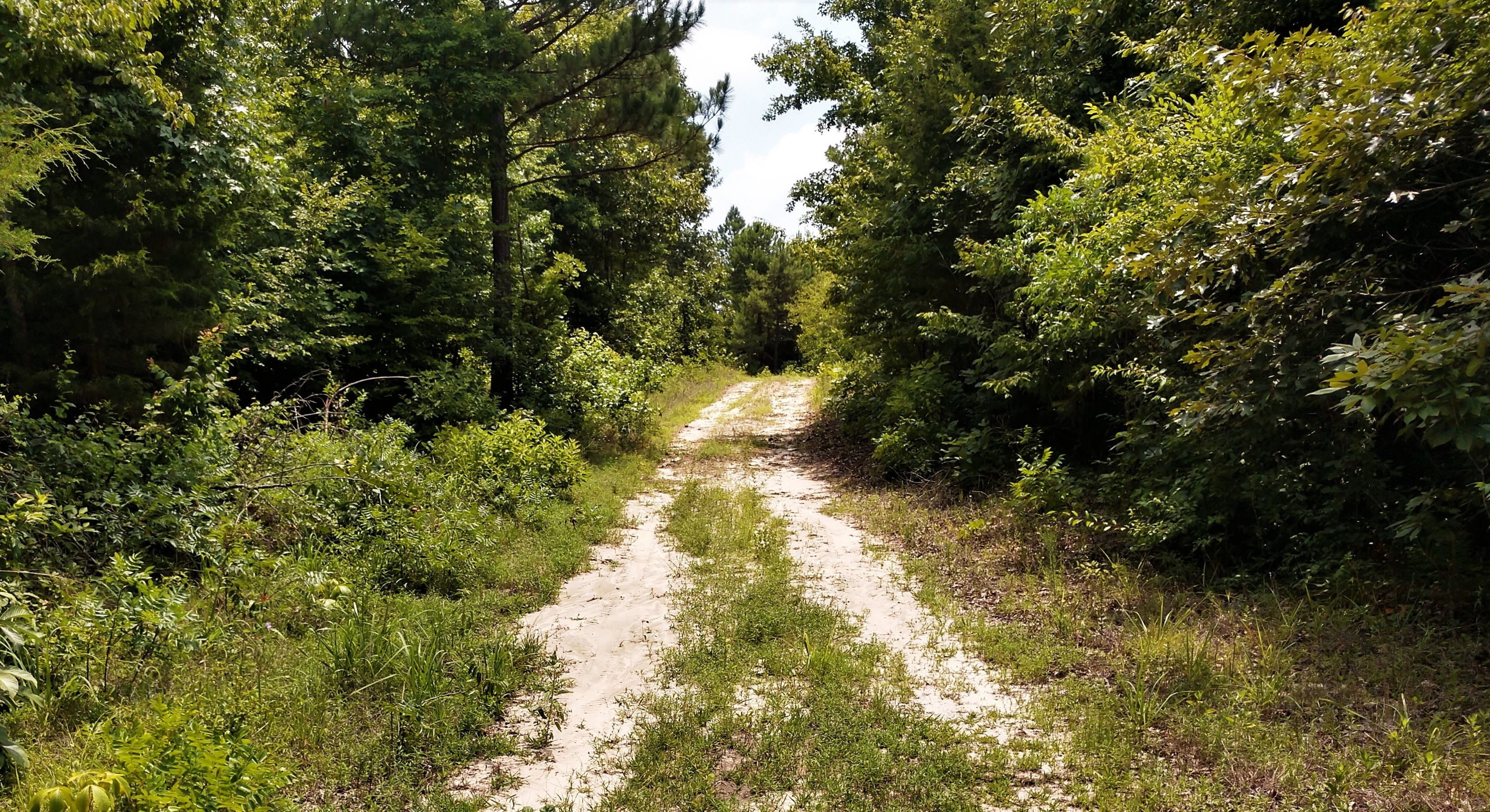
Good Internal Roads |
|
Access: Refer to maps.
Legal/Lines: All
boundaries in white RFC flagging,
most lines painted
yellow, white, or blue,
roads and old fences;
established GLO boundaries, no survey needed or provided.
240 deed acres, S½ SW¼ Section
13, T16S R20W, and NW¼ Section 24, T16S R20W
Location: Columbia County, in
Southwest Arkansas.
Offers: Offers
received by fax, email, web, mail, in-person and phone.
If you need assistance in determining
bid based on desired return rate (discount rate) utilizing custom growth-yield model, email or call; all your information is confidential.
Reservation: Minerals
reserved and seller reserves right to reject any and/or all offers.
Earnest:
10% within 5 business days of acceptance.
Closing: within 30 days of acceptance and administered
injunction with Crane & Phillips. Buyer’s title insurance, revenue stamps, and
closing administration fee divided equally. Taxes prorated. Closing costs
increased by buyer paid by buyer (10% per annum daily prorate fee for buyer
closing extension). No other terms exist outside this document unless duly
executed by all parties. Submitted bids (verbal & written) are legally binding
to all terms stated in this bid prospectus and deviating party responsible for
reimbursing legal costs related to ensuring compliance. Exceptions &
contingencies by bidder must be in writing with bid.
Disclosure: Reynolds Forestry does not
guaranty boundaries or volumes.
Contact:
colleen@reynoldsforestry.com
or
teddy@reynoldsforesry.com
or Colleen’s cell 870-299-0978 or Teddy 870-299-0977
with questions, tour,
or investment advice.
|
|
Return to
Timberland Sales Page |
|
 |
|

